 Zaire
Zaire
|
| Basic Facts |
| Country name |
conventional long form: Democratic Republic of the Congo
conventional short form: none local long form: Republique Democratique du Congo local short form: none former: Congo Free State, Belgian Congo, Congo/Leopoldville, Congo/Kinshasa, Zaire abbreviation: DRC |
| Gevernment type | transitional government |
| Capital |
name: Kinshasa
geographic coordinates: 4 18 S, 15 18 E time difference: UTC+1 (six hours ahead of Washington, DC during Standard Time) |
| Flag description | sky blue field divided diagonally from the lower hoist corner to upper fly corner by a red stripe bordered by two narrow yellow stripes; a yellow, five-pointed star appears in the upper hoist corner |
| Currency | Congolese franc (CDF) |
| Internet country code | .cd |
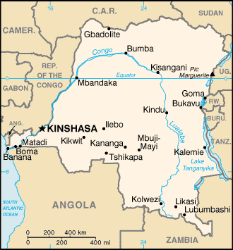
| Ports and terminals | Banana, Boma, Bukavu, Bumba, Goma, Kalemie, Kindu, Kinshasa, Kisangani, Matadi, Mbandaka |
| Agriculture products | coffee, sugar, palm oil, rubber, tea, quinine, cassava (tapioca), palm oil, bananas, root crops, corn, fruits; wood products |
| Industries | mining (diamonds, copper, zinc), mineral processing, consumer products (including textiles, footwear, cigarettes, processed foods and beverages), cement, commercial ship repair |
| Geography |
| Location | Central Africa, northeast of Angola |
| Coordinates | 0 00 N, 25 00 E |
| Continent | Africa |
| Area |
total: 2,345,410 sq km
land: 2,267,600 sq km water: 77,810 sq km |
| Boundaries |
total: 10,730 km
border countries: Angola 2,511 km (of which 225 km is the boundary of Angola's discontiguous Cabinda Province), Burundi 233 km, Central African Republic 1,577 km, Republic of the Congo 2,410 km, Rwanda 217 km, Sudan 628 km, Tanzania 459 km, Uganda 765 km, Zambia 1,930 km |
| Coastline | 37 km |
| Climate | tropical; hot and humid in equatorial river basin; cooler and drier in southern highlands; cooler and wetter in eastern highlands; north of Equator - wet season (April to October), dry season (December to February); south of Equator - wet season (November to March), dry season (April to October) |
| Terrain | vast central basin is a low-lying plateau; mountains in east |
| Natural resources | cobalt, copper, niobium, tantalum, petroleum, industrial and gem diamonds, gold, silver, zinc, manganese, tin, uranium, coal, hydropower, timber |
| Natural hazards | periodic droughts in south; Congo River floods (seasonal); in the east, in the Great Rift Valley, there are active volcanoes |
| People |
| Population | 62,660,551
note: estimates for this country explicitly take into account the effects of excess mortality due to AIDS; this can result in lower life expectancy, higher infant mortality and death rates, lower population and growth rates, and changes in the distribution of population by age and sex than would otherwise be expected (July 2006 est.) |
| Ethnic groups | over 200 African ethnic groups of which the majority are Bantu; the four largest tribes - Mongo, Luba, Kongo (all Bantu), and the Mangbetu-Azande (Hamitic) make up about 45% of the population |
| Religions | Roman Catholic 50%, Protestant 20%, Kimbanguist 10%, Muslim 10%, other syncretic sects and indigenous beliefs 10% |
| Languages | French (official), Lingala (a lingua franca trade language), Kingwana (a dialect of Kiswahili or Swahili), Kikongo, Tshiluba |
